A spatial dataset representing a discretized road transport network connecting major African cities and ports. The network combines existing road infrastructure (2,344 edges) with proposed new links (481 edges) identified through network efficiency analysis. Each edge contains distance, travel time, border crossing costs, terrain characteristics, and road upgrade cost estimates.
Usage
data(africa_network)Format
A Simple feature collection (sf object) with 2,825 LINESTRING features and 28 fields:
- from
Integer. Origin node index (1 to 1,377).
- to
Integer. Destination node index (2 to 1,379).
- from_ctry
Character. Origin country ISO3 code (49 countries).
- to_ctry
Character. Destination country ISO3 code (49 countries).
- FX
Numeric. Origin node longitude.
- FY
Numeric. Origin node latitude.
- TX
Numeric. Destination node longitude.
- TY
Numeric. Destination node latitude.
- sp_distance
Numeric. Spherical (great-circle) distance in meters.
- distance
Numeric. Road distance in meters from OSRM routing.
- duration
Numeric. Travel duration in minutes from OSRM routing (NA for proposed links).
- speed_kmh
Numeric. Average speed in km/h (distance/duration) (NA for proposed links).
- passes
Numeric. Number of optimal inter-city routes passing through this edge (NA for proposed links).
- gravity
Numeric. Sum of population gravity weights from routes using this edge (NA for proposed links).
- gravity_rd
Numeric. Sum of road-distance-weighted gravity from routes (NA for proposed links).
- border_dist
Numeric. Additional distance for border crossing in meters (0 for domestic links).
- total_dist
Numeric. Total distance including border crossing penalty in meters.
- border_time
Numeric. Additional time for border crossing in minutes.
- total_time
Numeric. Total travel time including border crossing in minutes.
- duration_100kmh
Numeric. Hypothetical travel time at 100 km/h in minutes.
- total_time_100kmh
Numeric. Hypothetical total time at 100 km/h including border penalties.
- rugg
Numeric. Terrain ruggedness index along the edge.
- pop_wpop
Numeric. Population within corridor (WorldPop data).
- pop_wpop_km2
Numeric. Population density per km2 along corridor.
- cost_km
Numeric. Estimated road construction/maintenance cost per km in USD.
- upgrade_cat
Character. Road upgrade category: "Nothing", "Asphalt Mix Resurfacing", "Mixed Works", "Upgrade", or NA.
- ug_cost_km
Numeric. Upgrade cost per km in USD.
- add
Logical. TRUE for proposed new links, FALSE for existing road network edges.
- geometry
LINESTRING. Spatial geometry in WGS 84 (EPSG:4326) coordinate reference system.
Source
Road network derived from OpenStreetMap via OSRM routing. Border crossing data from World Bank estimates. Terrain data from SRTM elevation models. Population data from WorldPop.
Dataset constructed for: Krantz, S. (2024). Optimal Investments in Africa's Road Network. Policy Research Working Paper 10893. World Bank. doi:10.1596/1813-9450-10893 . Replication materials: https://github.com/SebKrantz/OptimalAfricanRoads.
Details
The network was constructed through the following process:
Computing optimal routes between all city pairs within 2,000km using OSRM
Filtering routes using network efficiency criteria (alpha = 45 degrees, EU-grade efficiency)
Intersecting and aggregating overlapping route segments
Contracting the network to reduce complexity while preserving connectivity
Identifying proposed new links that would improve network route efficiency
Adding border crossing costs based on country pairs
Computing terrain, population, and road cost attributes
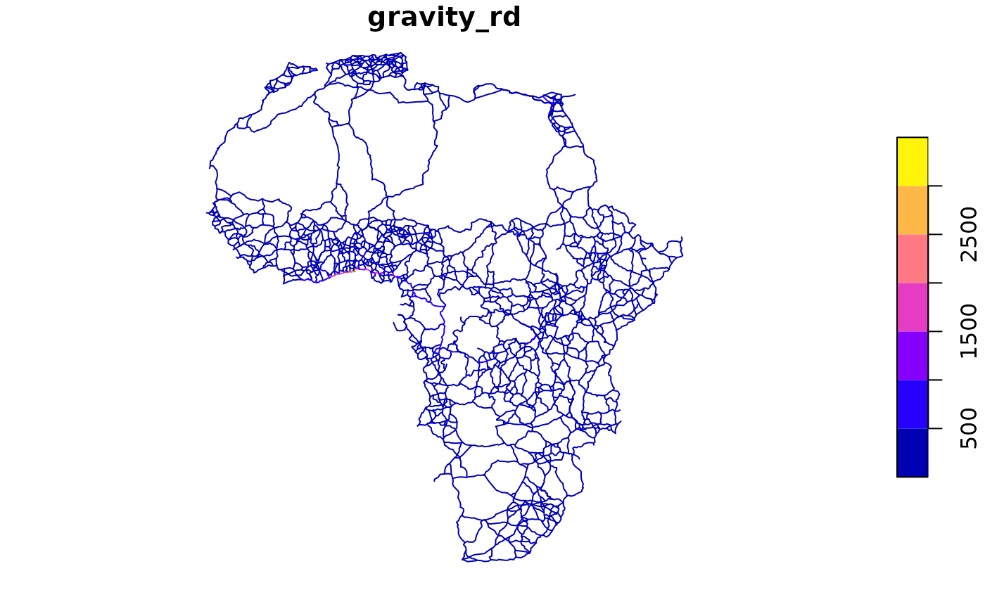
The gravity and gravity_rd fields measure edge importance based on the population
gravity model: routes between larger, closer cities contribute more weight to edges they traverse.
The bounding box spans continental Africa from approximately 34S to 37N latitude and 17W to 49E longitude.
Examples
library(sf)
data(africa_network)
head(africa_network)
#> Simple feature collection with 6 features and 28 fields
#> Geometry type: LINESTRING
#> Dimension:     XY
#> Bounding box:  xmin: -17.44671 ymin: 14.34236 xmax: -16.24391 ymax: 15.63569
#> Geodetic CRS:  WGS 84
#>   from to from_ctry to_ctry        FX       FY        TX       TY sp_distance
#> 1    1  2       SEN     SEN -17.44671 14.69281 -17.04453 14.70297    43272.22
#> 2    2  3       SEN     SEN -17.04453 14.70297 -16.63849 15.11222    63043.01
#> 3    2  4       SEN     SEN -17.04453 14.70297 -16.46332 14.75651    62786.56
#> 4    2  5       SEN     SEN -17.04453 14.70297 -16.42054 14.34236    78226.09
#> 5    3  4       SEN     SEN -16.63849 15.11222 -16.46332 14.75651    43802.37
#> 6    3 10       SEN     SEN -16.63849 15.11222 -16.24391 15.63569    71956.96
#>   distance duration speed_kmh   passes     gravity  gravity_rd border_dist
#> 1  65988.0    46.15  85.79155 104.3333 215.3302926 157.5228265           0
#> 2  87290.5    72.25  72.49038  10.0000  20.1382178  14.7376257           0
#> 3  89469.5    61.10  87.85876   1.5000  11.6420372  10.5577017           0
#> 4  99998.0    72.90  82.30288  55.0000 122.2011739  88.0080152           0
#> 5  61111.5    72.90  50.29753   1.0000   0.5259515   0.3953356           0
#> 6  73391.0    61.20  71.95196  31.0000  23.0342955  16.8520354           0
#>   total_dist border_time total_time duration_100kmh total_time_100kmh      rugg
#> 1    65988.0           0      46.15         39.5928           39.5928 25203.645
#> 2    87290.5           0      72.25         52.3743           52.3743 23656.895
#> 3    89469.5           0      61.10         53.6817           53.6817 25761.240
#> 4    99998.0           0      72.90         59.9988           59.9988 24773.338
#> 5    61111.5           0      72.90         36.6669           36.6669 11331.973
#> 6    73391.0           0      61.20         44.0346           44.0346  1745.889
#>    pop_wpop pop_wpop_km2  cost_km             upgrade_cat ug_cost_km   add
#> 1 670689.38    2262.9802 699437.0 Asphalt Mix Resurfacing   165533.4 FALSE
#> 2 191412.11     450.2150 605210.4             Mixed Works   325804.9 FALSE
#> 3 177027.86     415.0577 607229.6 Asphalt Mix Resurfacing   143711.0 FALSE
#> 4 137874.58     262.0664 581289.6 Asphalt Mix Resurfacing   137571.9 FALSE
#> 5  65316.04     216.0512 520634.9                 Upgrade   440804.2 FALSE
#> 6 102835.91     212.9464 415457.6             Mixed Works   223654.7 FALSE
#>                         geometry
#> 1 LINESTRING (-17.44671 14.69...
#> 2 LINESTRING (-17.04453 14.70...
#> 3 LINESTRING (-17.04453 14.70...
#> 4 LINESTRING (-17.04453 14.70...
#> 5 LINESTRING (-16.63849 15.11...
#> 6 LINESTRING (-16.63849 15.11...

# Existing vs proposed links
table(africa_network$add)
#>
#> FALSE  TRUE
#>  2344   481

# Cross-border links
cross_border <- africa_network[africa_network$from_ctry != africa_network$to_ctry, ]
nrow(cross_border)
#> [1] 457

# Upgrade categories
table(africa_network$upgrade_cat, useNA = "ifany")
#>
#> Asphalt Mix Resurfacing             Mixed Works                 Nothing
#>                     628                     901                       5
#>                 Upgrade                    <NA>
#>                     810                     481

# \donttest{
# Plot by gravity
plot(africa_network["gravity_rd"])

# Highlight proposed new links
plot(africa_network[africa_network$add, "geometry"], col = "red", add = TRUE)

# }
# }